23 February 2026
1300 794 893

Climate risks are hitting where Australians feel it most: at home.
One of the headline-grabbing figures in a new climate risk assessment was that Australian property values could take a A$611 billion hit by 2050, under a 3°C warming scenario.
That level of warming is something Australia needs plan for. As a new National Adaptation Plan, also released yesterday, said:
it is prudent to plan for global warming levels of 2°C to 3°C by the end of this century, with temperatures in Australia likely to track higher than the global average.
But what does that $611 billion hit to property values actually mean? And what more can we do to better protect our homes – including 1.5 million of them already at high or very high risk today?
Australia’s first comprehensive National Climate Risk assessment, released yesterday, forecasts losses in Australian “property values” could reach $571 billion by 2030 under a 3°C warming scenario. By 2050, that could hit $611 billion.
To be clear, that isn’t the bill to repair or rebuild homes after disasters. And it doesn’t include the cost of replacing public assets such as roads, bridges or power stations.
It’s the drop in market value of properties as climate risk becomes clearer, buyers pay less, banks may value homes lower, and insurance can get more expensive or harder to obtain.
For example, if a house that might have sold for $800,000 without these risks sells for $720,000 once flood risk and higher premiums are factored in, that $80,000 difference is a “loss in value”.
Aggregated across the country, those individual discounts add up to the assessment’s forecast of $611 billion by 2050.
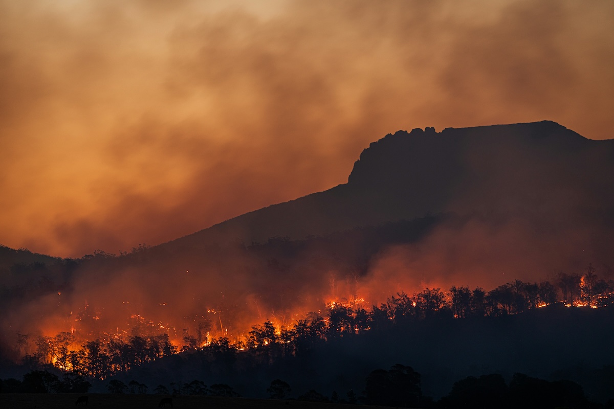
The assessment found about 751,000 (8.2%) of residential buildings are currently located in “high risk” areas for floods, bushfires, tropical cyclones and heatwaves, while 794,000 (8.7%) are in “very high risk” areas. That’s a total of more than 1.5 million homes today.
Even under a conservative 2°C warming scenario, that’s expected to rise to 789,000 homes (8.9%) in high-risk areas, and more than 1 million (11.1%) in very high-risk areas.
And you don’t have to own a beachfront home to be at growing risk from rising sea levels.
The assessment found 1.5 million people in coastal communities – especially in low-lying areas within 10 kilometres of soft shorelines – could be in high and very high risk areas for coastal flooding and erosion by 2050. That could grow to a third of coastal communities – home to more than 3 million people – by 2090 if populations stayed put.
The new assessment also warns insurance affordability and availability are likely to worsen, with flow-on effects to mortgages and house prices if insurance cover is withdrawn.
Direct impacts from floods, coastal inundation, fires, wind and subsidence could more than double the number of properties classed as high risk by 2100.
For some homes, insurance premiums could rise enough to knock 10% off the property value.
That all assumes things stay the same as they are today. Governments, communities and households can all do more in response to these two new reports.
Australia’s new adaptation plan is a start. It outlines national leadership across seven systems and sets out $3.6 billion committed since 2022 and around $9 billion to 2030 for measures that support resilience. These include the $1 billion Disaster Ready Fund and urban river cooling projects.
But what else would help?
The federal government is expected to announce its new emissions reduction targets this week.
In the meantime, there are four pillars of practical adaptation that would give Australians greater confidence, all of which align with the new assessment’s evidence.
1) National floodplain mapping with consistent data: Australians need clear, comparable hazard bands to guide land-use planning and building decisions. The assessment points to risk-based planning and building codes as core tools. National mapping would feed these directly.
2) Open-access extreme weather–water models: publicly accessible tools linking rainfall, rivers, floodplains and coasts, so councils and insurers can stress-test decisions off the same, transparent system.
3) Continuous monitoring and event forensics: after every major flood, fire or storm, we need to collect consistent exposure, damage and claims data to reconstruct what failed – and why. This would support the adaptation plan’s push for effective, evidence-based adaptation and would avoid investing in measures that don’t work.
4) Regional ‘testbeds’ linking researchers, councils and insurers: piloting risk-based planning, climate-adjusted building codes, and nature-based coastal protections (such as mangroves) in high-risk regions. After testing, we then need to scale up what works.
This would help us develop more community-level plans to reduce damage bills and make homes insurable for longer.
If you’re in a flood-prone street, elevate electrics and appliances and use flood-tolerant materials. In bushfire zones, ember-proof vents and upgrade roofs and gutters.
Rooftop solar plus batteries and local community microgrids can help keep the power on during heat and storms. The assessment lists microgrids and storage as practical adaptation measures for energy resilience.
Finally, try using the assessment report’s new interactive online maps to understand your local risk. These show where climate risks are already high (for example, parts of northern Australia and coastal areas) and how it grows with increased warming.![]()
Ehsan Noroozinejad, Senior Researcher and Sustainable Future Lead, Urban Transformations Research Centre, Western Sydney University
This article is republished from The Conversation under a Creative Commons license. Read the original article.